

Aerial Survey for Private Airstrip Improvement Planning
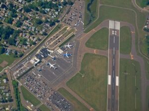
A private airstrip that served one owner well for years can turn into a puzzle once you decide to lengthen it, pave it, or add a hangar. Low spots hold water, trees creep toward the approach, and the original layout may not line up with your deed lines. An aerial survey gives you a measured picture of the strip and the land around it before anyone moves dirt, so your engineer and contractor design from facts instead of guesses.
Many owners start by asking what the paving will cost. A better first step is knowing exactly what you’re working with. Runway slope, drainage paths, nearby obstacles, and boundary limits all shape what you can build and what it will cost, and getting that data early saves redesign work later.
Why an Aerial Survey Matters Before Private Airstrip Improvements
An aerial survey collects measured images or laser data from a drone or crewed aircraft and turns it into maps, surface models, and contour lines. For an airstrip, that means you can see the full runway, the approach zones, and the surrounding terrain in one dataset. A ground crew could walk a long strip and shoot points, but it takes more time and can miss the subtle grade changes that matter to pilots.
The bigger benefit is coverage. Problems near an airstrip rarely stop at the edge of the turf or pavement. Drainage can start on a slope a quarter mile away, and a tall structure past the runway end can limit how far you extend. Capturing the whole area at once helps your design team catch these issues before they become change orders.
Mapping Runway Conditions, Terrain, and Drainage With Aerial Survey Data
Aerial survey data shows how the existing runway really sits on the ground. Photogrammetry builds an orthomosaic, which is a scaled, distortion-corrected aerial photo you can measure from. LiDAR uses laser pulses that can reach the ground through sparse brush and produce a dense elevation model.
From that data, your team can measure lengthwise grade, cross slope, rutting, and low spots that often point to soft ground. Drainage gets the same close look. Contour lines and flow paths show where runoff crosses the strip, where it ponds, and where it leaves the property. Water sitting on a runway softens the base and shortens the life of any surface you add, whether it’s turf, gravel, or asphalt.
Identifying Obstacles, Property Boundaries, and Airstrip Safety Constraints
Obstacles are often the deciding factor in how far a runway can grow. An aerial survey can locate and measure the height of trees, power lines, fences, buildings, and terrain rises near the runway ends and along the sides. Your engineer can then compare those heights against the approach slopes and clear areas used in the design. Guidance for private-use strips can differ from public airports, so ask your consultant which standards apply to your project.
Boundaries need a careful approach. Aerial imagery shows where fences and roads sit, but it doesn’t establish legal property lines. A licensed surveyor should tie the aerial data to a boundary survey based on deeds, plats, and found monuments. That step shows whether an extension, taxiway, or safety area would cross onto a neighbor’s land or into an easement.
Using Aerial Survey Data for Runway Grading and Site Design
Good grading starts with an accurate existing surface. The aerial survey becomes the base map your civil engineer designs on, with contours and spot elevations across the site. From there, the engineer sets a proposed runway profile, cross slope, and shoulder grades. Design software compares the existing and proposed surfaces to estimate cut and fill volumes.
Those volumes drive a large share of the budget. A design that balances cut and fill on site can avoid hauling soil in or out, which adds up fast on a long strip. The same model helps size ditches, culverts, and swales so runoff moves away from the runway. If you plan hangars, a fuel area, or tie-downs, placing them on the base map now keeps everything working together.
How Aerial Survey Findings Support Construction Planning and Project Approvals
Contractors bid more accurately when they can see the site in detail. Sharing the orthomosaic and surface model gives them clear quantities, haul routes, and staging areas. It also cuts down on surprise conditions after work starts. Many contractors load the design surface into machine control equipment, which depends on solid survey control.
Approvals are the other half. Depending on the project, you may need grading or building permits, a drainage review, or notice to the FAA before building or altering a private-use landing area. Requirements vary by airstrip use, county, and project scope, so confirm them with your engineer and the right agencies early. Clear survey-based exhibits make those submissions easier to review and can reduce back-and-forth comments.
Frequently Asked Questions
How accurate is an aerial survey for airstrip planning?
Accuracy depends on the sensor, flight height, and how much ground control the surveyor sets. With good control points, drone surveys can reach a few centimeters of accuracy on open ground. Dense brush and tall grass can reduce accuracy for bare-earth elevations. Ask your surveyor to state the expected accuracy in writing before the flight.
Is a drone or a crewed aircraft better for a private runway?
Drones work well for most private airstrips because they fly low and capture fine detail. Crewed aircraft may make sense for very large sites or long corridors. Flight rules apply either way, and flying near an active strip takes coordination. Your surveyor should handle airspace checks and plan flights around aircraft activity.
Can an aerial survey replace a boundary survey?
No. Aerial data shows physical features such as fences and roads, but legal lines come from deeds, plats, and monuments on the ground. A licensed surveyor has to research records and verify those lines in the field. Combining both surveys shows you where improvements can safely go.
How long does an aerial survey take?
Field work on a typical private airstrip can often be done in a day, weather permitting. Setting ground control may add time before the flight. Processing the data and building the surface model usually takes longer than the flight itself. Turnaround varies by site size and deliverables, so ask for a schedule up front.
What should I have ready before ordering the survey?
Gather your deed, any old plats or surveys, and notes about past drainage problems or soft spots. A rough sketch of planned improvements helps the surveyor set the right coverage area. Let them know about aircraft traffic, livestock, or locked gates that affect site access. Sharing your project timeline also helps them plan delivery around design and permit dates.