

ALTA Land Survey for Desert Event Venue Property Purchase
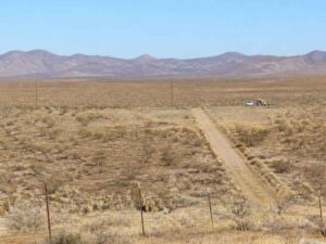
An event venue lives in open space, clear access, and room to grow. A desert parcel can offer all three at a good price. But raw desert land hides risks that a listing photo never shows. Buy without checking, and those risks become your problem.
An ALTA Land Survey is how serious buyers check. It is a detailed survey built to a national standard used by lenders and title companies. It maps the boundaries, the access, and the recorded rights that shape what you can build. For a venue purchase, that information can decide whether the site works at all.
The stakes are high in a place like Pahrump, where large desert tracts trade often. Wide-open land can look simple and still carry easements, access gaps, or boundary questions. This guide walks through what an ALTA Land Survey checks and why each part matters for a venue.
Title and Boundary Conditions Across the Desert Property
The survey starts with two basic questions. Where does the property really end? And what recorded matters affect it? An ALTA Land Survey answers both by comparing the land to the records.
The surveyor gathers the deeds, the title documents, and the recorded plats. Then they go to the field and find the evidence on the ground. That includes corner monuments, fences, and other markers. They compare the two to confirm the true property limits.
This matters more on desert land than people expect. Corners can be buried, moved, or missing after years of open use. Old descriptions may not match what a modern survey finds. A venue needs firm boundaries before anyone plans parking, stages, or buildings.
The survey also flags title matters tied to the land. These are recorded interests that can limit your use. The ALTA standard is built to show these clearly. Knowing them before closing protects both you and your lender.
Legal Access for Guests, Vendors, and Emergency Services
Access can make or break an event venue. Hundreds of guests may arrive at once. Vendors need to bring in trucks. Emergency services must reach the site fast. A venue with poor legal access is a venue with a problem.
Legal access means a recorded right to reach the property from a public road. It is not the same as a dirt path people happen to use. An ALTA Land Survey confirms whether that legal right exists. On remote desert parcels, this is a common gap.
The surveyor reviews the recorded access rights for the site. They map the adjoining roads and the visible entry points. Then they check whether those match. A driveway crossing a neighbor’s land without a recorded easement is a real risk.
Here is what strong venue access usually needs:
- A recorded legal connection to a public road
- Road width and layout that can handle event traffic
- Clear routes for vendors and delivery vehicles
- Access that meets local emergency service requirements
Access rules can vary by county and project. Confirm them early with your surveyor and local officials. Fixing an access gap after closing is slow and costly.
Easements Affecting Parking and Event Facilities
An easement gives someone else the right to use part of your land. Desert parcels often carry more than buyers realize. A utility corridor or a roadway easement can sit right where you planned to build. An ALTA Land Survey shows these before you commit.
The survey maps the recorded easements that affect the property. These can include several types:
- Utility corridors for power, water, or pipelines
- Roadway easements that grant others passage
- Access agreements tied to neighboring land
- Drainage or flood-control interests
Each easement shapes your site plan. A power line easement may block the best spot for a stage. A utility corridor may cut through your planned parking. Building over an easement can lead to costly conflicts later.
For a venue, parking is often the biggest land use. You need a lot of it, and it has to sit in the right place. The survey helps you see where easements limit your options. That lets you design parking and gathering spaces around real constraints, not guesses.
Knowing these interests early changes your whole approach. You can shift a building, reroute a driveway, or rethink the layout on paper. That is far cheaper than moving it after construction starts.
Existing Improvements and Signs of Property Use
Desert land is rarely untouched. Old fences, roads, and structures often dot the property. An ALTA Land Survey documents these visible improvements. They can reveal boundary issues and hidden claims.
The surveyor records what stands on the site today. That includes structures, fences, dirt roads, and any parking surfaces. Each feature gets located against the property lines. This shows whether anything crosses a boundary.
These improvements tell a story about use. A fence that sits inside the deed line may hint at a boundary question. A road worn across the parcel may signal that others use the land. A structure near the edge may encroach on a neighbor. The survey brings these facts to light.
Signs of use also connect to title exceptions. Recorded exceptions are items the title insurance will not cover. The survey helps match physical evidence to those exceptions. That link helps the buyer and lender understand the real risk before closing.
Optional Survey Details for the Planned Venue
An ALTA Land Survey has a flexible part called Table A. These are optional items the buyer can add to the survey. They let you tailor the survey to your specific plans. For a venue, the right add-ons can be well worth it.
Table A items cover extra details beyond the base survey. Common choices include topographic data, flood zone information, and zoning details. The buyer, lender, title company, and surveyor decide together which ones fit. The transaction and the planned use guide that choice.
For a desert venue, a few items often make sense. Topographic data helps with grading, drainage, and pad design. Flood zone details matter near desert washes that flow hard in storms. Utility information helps you plan power and water for large events.
Requirements and useful add-ons vary by lender, title company, and project scope. There is no single checklist that fits every deal. Talk with your survey and title team early about which Table A items serve your goals. That conversation shapes a survey that answers your real questions.
Frequently Asked Questions
What is an ALTA Land Survey?
It is a detailed boundary survey made to a national standard set by ALTA and NSPS. Lenders and title companies often require it for commercial deals. It maps boundaries, easements, access, and improvements, and ties them to the title records. For a venue purchase, it gives a full picture of what you are buying.
Why does a desert venue need one?
Open desert land can hide access gaps, easements, and boundary problems. A venue depends on clear access, usable parking, and firm lines. An ALTA Land Survey reveals these issues before closing. That lets you plan the site with confidence or walk away from a bad deal.
When should I order the survey?
Order it early in the buying process, well before your closing date. The survey may uncover access or easement issues that take time to resolve. Ordering early gives you room to fix problems or renegotiate. Requirements vary by lender and title company, so confirm the scope up front.