

Boundary Line Survey for Rural Zone Change Parcel Exhibits
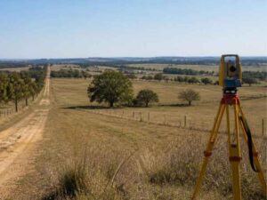
A rural rezoning starts with a clear map. That map has to show your exact property lines. If the lines are wrong, the whole request can stall. A boundary line survey gives you the correct lines before you file.
A boundary line survey finds and marks the legal edges of your land. A licensed surveyor locates each corner and measures each line. The work rests on your deed, past records, and careful field checks. The end product is a map you can trust.
This matters a lot for a zone change. Planning staff study your parcel to decide if the new zoning fits. They need a clear, correct picture of the land. A good survey gives them that picture. It also helps your request move ahead with fewer delays.
Parcel Boundaries Required for Rural Zone Change Exhibits
A zone change exhibit is a map you file with your rezoning request. It shows the parcel you want to rezone. The main feature on it is the parcel boundary. That boundary must match your legal property lines.
A boundary line survey creates those lines. The surveyor confirms where your land starts and stops. They compare your deed to records and to marks found in the field. Then they draw the parcel to scale. This gives reviewers a true outline of the area in question.
Rural parcels can be large and oddly shaped. Old fences, tree lines, and dirt roads may not sit on the real line. What you see on the ground isn’t always the legal line. A survey clears up that gap. It shows the true boundary, backed by measurements and records.
There’s also the problem of old paperwork. Many rural deeds were written long ago. The words in them can be vague or hard to match to the land today. A surveyor reads that language and ties it to real points on the ground. This turns an old description into a clear, current map.
Every county can ask for the exhibit in its own way. Some want a certain scale or set of labels. Confirm the format your local planning office wants early. That saves you from redoing the map later.
Key Survey Details Shown on a Zoning Exhibit
A zoning exhibit shows more than a plain outline. It carries the details that planners use to judge the request. A boundary line survey supplies most of those details in a clean, readable form.
Common items on the exhibit include:
- The parcel lines with their length and direction
- The corners and the markers set at each one
- The total acreage of the parcel
- Known easements and rights of way
- Adjoining parcels and who owns them
- A north arrow and a clear map scale
Line direction and length are shown as bearings and distances. A bearing tells you which way a line runs. A distance tells you how long it is. Together they lock the shape of your parcel in place.
Easements deserve a close look on any exhibit. An easement is a right for someone else to use part of your land. It might cover a power line, a shared road, or a drainage path. Planners want to see these, since they affect how the land can be used.
Each item helps a reviewer read the map fast. Clear lines and labels cut down on questions. Fewer questions can keep your rezoning on schedule. A crowded or vague map does the opposite and slows things down.
Rural Acreage, Adjoining Parcels, and Existing Site Features
Rural land brings its own set of questions. Parcels tend to be big. Access may run across other property. A boundary line survey helps sort all of this out before you file.
The survey shows how your parcel sits next to its neighbors. It marks the shared lines with adjoining owners. This helps you avoid disputes over where one property ends and the next starts. It also shows if a road or driveway crosses a line.
Existing features matter too. The surveyor can note buildings, wells, fences, and utility lines. These features affect how the new zoning would work on the site. A reviewer wants to see what’s already there before approving a change.
Access is a common snag on big rural tracts. Some parcels only reach a public road through a neighbor’s land. That kind of access runs on an easement, and it should show on the map. Knowing this early can save you from a costly surprise.
Water is a big factor on rural land. Drainage paths, ditches, and washes can shape what you build. Ask your surveyor whether these should appear on the exhibit. The answer can vary by county and by the type of project you plan.
Survey Accuracy During Planning and Zoning Review
Accuracy is the whole point of this step. A zone change decision rests on the map you hand in. If the boundary is off, the review can be delayed or even denied. A precise boundary line survey lowers that risk.
Licensed surveyors follow set standards for their work. They use records, math, and field measurements to fix each line. They also set or find physical markers at the corners. These markers give your exhibit a strong, provable base.
Planning staff and engineers may check your survey against county records. They look for gaps, overlaps, or math errors. A clean survey holds up well to that check. A weak one invites more questions and more delay.
A survey can also protect you if a neighbor objects. Some rezoning cases draw pushback at a hearing. A firm set of property lines answers many of those concerns fast. It keeps the talk focused on the plan, not on where the lines fall.
Accepted standards can vary by county and by land use. What passes for one project may not fit another. Confirm the local rules before you submit your exhibit. Your surveyor can help you match them.
The Role of a Boundary Line Survey in the Zone Change Process
A zone change moves through several steps. You file an application. Staff review it. A board or commission often holds a public hearing. A boundary line survey supports each of these steps.
At filing, the survey gives you a correct exhibit to attach. During review, it answers boundary questions before they slow things down. At a hearing, a clear map helps officials and neighbors follow the request. Solid data builds trust in your plan.
Timing counts as well. A survey takes time to schedule and complete. On large rural sites, the field work can take longer. Rushing it at the end can push back your whole request.
Order the boundary line survey early, so it’s ready when you file. Ask your surveyor what they need from you to start. Gather your deed and any past surveys ahead of time. The exact steps and timelines vary by municipality and project, so check with your planning office up front.