

Lidar Mapping Nevada for Mine Reclamation Terrain Models
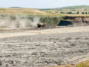 A closed mine site can cover hundreds of acres of pits, benches, haul roads, and waste rock piles. Reclaiming that ground means reshaping it into stable slopes that drain properly and support restoration. None of that works without an accurate picture of the terrain as it stands today.
LiDAR mapping gives reclamation teams that picture. It captures millions of elevation points across the site and turns them into terrain models engineers can design from, contractors can grade to, and regulators can review. For mine operators, reclamation engineers, and earthwork contractors, the takeaway is simple: start with good terrain data, and the rest of the reclamation plan gets easier to build and defend.
Capturing Existing Mine Terrain with LiDAR Mapping
LiDAR stands for light detection and ranging. A sensor mounted on a drone, crewed aircraft, or ground vehicle sends out laser pulses and measures how long each one takes to bounce back. The result is a point cloud, a dense 3D set of measured points that represents the ground and everything on it.
Open desert terrain is well suited to LiDAR mapping in Nevada and similar dry regions. Sparse vegetation lets more laser pulses reach bare ground, which improves the accuracy of the final surface. Steep pit walls and deep benches that are unsafe to walk can be captured from the air.
Drones work well for smaller sites or focused areas like a single waste rock dump. Crewed aircraft cover very large mine footprints faster. Mobile or terrestrial scanners can fill gaps along highwalls and under overhangs.
Before the flight, the surveyor sets ground control points, which are marked targets measured with high-accuracy GPS. These points tie the LiDAR data to a known coordinate system and elevation datum. Ask your surveyor which datum and coordinate system the deliverables will use so they match your engineering files.
Developing Elevation Models for Reclamation Design
Raw point clouds are processed into elevation models engineers can work with. The most useful for reclamation is a digital terrain model, often called a DTM or bare-earth model. It removes equipment, structures, and vegetation to show the true ground surface.
Common deliverables include:
- Bare-earth terrain models and surface files
- Contour maps at the interval your design requires
- Digital surface models showing structures and stockpiles
- Orthophotos for visual reference
Point density and accuracy should match the purpose. Detailed slope design and volume calculations need more precision than a general site overview. Agree on accuracy targets with your engineer before the data is collected.
The terrain model becomes the existing-conditions base for reclamation design. Engineers compare it with the planned final landform to calculate cut, fill, and haul distances. Mistakes in that base surface carry through every number in the plan.
Mapping Mine Slopes, Waste Rock Areas, and Drainage Paths
Slope stability is one of the first things reclamation designers check. LiDAR terrain models make it easy to measure slope angles across pit walls, benches, and dump faces. Steep or oversteepened areas can be flagged for regrading.
Waste rock dumps and tailings areas need close attention. LiDAR shows their shape, height, and volume, which helps engineers plan how much material needs to move. It also reveals settlement, slumping, or erosion that may not be obvious from the ground.
Drainage paths come straight from the terrain data. Flow analysis shows where water will travel during a storm, where it collects, and where it may cut gullies. Desert storms can be brief but intense, so even small channels matter on a reclaimed slope.
Mapping erosion features like rills and gullies now gives you a baseline. Those features show where water has already caused damage. They also highlight where new channels, berms, or rock armoring may be needed.
Using Terrain Data to Plan Regrading and Site Restoration
With accurate terrain data, engineers can design the final landform. The plan may reshape slopes to gentler grades, fill pits, cap waste areas, and route water through stable channels. Reclamation plans often set specific slope and drainage criteria, which can vary by permit, agency, and site conditions.
The terrain model supports quantity calculations. Engineers can estimate how much material needs to move and where it should go. Accurate volumes help contractors bid the work and plan equipment and haul routes.
Grading designs can be loaded into machine control systems on dozers and excavators. That lets operators shape the ground to the design surface with fewer stakes and less rework. It’s especially helpful on large, open areas where traditional staking would be slow.
Restoration planning uses the same data. Revegetation crews can see slope aspect, drainage, and soil placement areas on the model. Confirm reclamation requirements with the permitting agency early, since they shape the final grading design.
Comparing Terrain Models to Document Reclamation Progress
LiDAR is valuable after work starts, too. Repeat surveys at set intervals create a series of terrain models that can be compared. The difference between two surfaces shows exactly where material was moved and how much.
This comparison, often called change detection, has several uses:
- Tracking regrading progress against the design surface
- Verifying contractor quantities for payment
- Spotting erosion or settlement after storms
- Supporting reports to regulators or bond release reviews
Consistent methods matter. Each survey should use the same coordinate system, datum, and accuracy standards so the comparisons are reliable. Keep ground control monuments protected and in place between flights when possible.
Long-term monitoring may continue for years after grading is complete. Requirements for monitoring and documentation can vary by agency, permit, and site. Plan the survey schedule with your reclamation team so data collection lines up with reporting deadlines.
Frequently Asked Questions
What is LiDAR mapping for mine reclamation?
LiDAR mapping uses laser pulses to measure ground elevations across a mine site. The data creates detailed terrain models of pits, slopes, and waste areas. Engineers use those models to design regrading and drainage. Repeat surveys track progress during and after reclamation.
How accurate is LiDAR for mine sites?
Accuracy depends on the sensor, platform, flight height, and ground control. Projects usually set accuracy targets based on design and reporting needs. Ground control points and check shots help confirm results. Ask your surveyor what accuracy the deliverables will meet.
Is drone LiDAR or aircraft LiDAR better for mines?
It depends on site size and detail needs. Drones work well for smaller areas and focused mapping. Crewed aircraft cover very large sites more efficiently. Some projects combine both with ground scanning for highwalls.
How often should a reclamation site be surveyed?
Frequency depends on project phase, permit requirements, and how fast work progresses. Active regrading may call for frequent surveys to track quantities. Monitoring after grading may happen less often or after major storms. Your reclamation plan and agency requirements should guide the schedule.
Can LiDAR data be used for regulatory reporting?
Many operators use LiDAR terrain models in reclamation reports. The data can show slopes, volumes, and changes over time. Reporting requirements vary by agency and permit. Confirm what format and accuracy reviewers expect before collecting data.