

Topo Survey for Desert Equestrian Arena Site Grading Plans
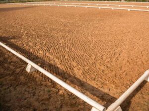
A flat looking desert lot can hide a lot of problems once an arena goes in. Small grade changes seem harmless on a dry, dusty afternoon. But they can turn into standing water, bad footing, or drainage that runs the wrong way after a rare desert storm. Large lots and equestrian properties are common. Getting the grading right before construction starts saves real money later.
A topo survey fixes this problem. It maps the exact shape of the land before an arena design is final. It records elevations, slopes, and existing site features. That way, an engineer or arena builder knows exactly what they are working with. Skipping this step often means guessing at grades that turn out wrong once dirt starts moving.
This article walks through how a topo survey supports site grading plans for a desert equestrian arena. It covers everything from the first layout to long term site records.
Verify Final Locations of New Treatment Infrastructure
Before arena grading starts, a topo survey confirms the exact spot of features already on the property. This includes barns, wash racks, water troughs, fencing, and other structures near the arena site.
Desert properties often have improvements added over time without a formal survey. A topo survey ties these features into accurate coordinates. That way, the arena design can work around them instead of clashing with them.
This step typically confirms:
- Coordinates and locations of existing barns, sheds, and arena related structures
- Positions of fencing, gates, and access points near the proposed arena
- Locations of wells, water tanks, or other water related features already on site
- Any planned structure that needs to tie into the same coordinate system as the arena
Getting this right early avoids a common problem on larger rural lots. An arena design based on rough measurements can end up clashing with something already built on the property.
Document Finished Elevations Across Expanded Facility Areas
Arena footing depends a lot on correct grading. Correct grading depends on accurate elevation data across the whole site, not just the arena spot. A topo survey documents existing elevations across the full area the project touches.
This matters most in desert conditions. Soil here often sheds water fast during the rare but sometimes heavy storms that hit the region. An arena built without checking the grades around it can end up collecting runoff from higher ground nearby.
Elevation data should include:
- Existing ground elevations across the arena site and the buffer area around it
- High points and low points that affect how water moves across the property
- Elevation differences between the arena pad and nearby barns or access roads
- Any existing drainage patterns already visible on the property
This data becomes the base for the whole grading plan. Without it, an arena builder is basically guessing at slope and drainage instead of using real numbers.
Map Completed Piping, Utilities, and Access Improvements
Many equestrian properties in the Pahrump area rely on wells, buried water lines, and electrical service that run across the site. These lines reach barns, arenas, and other buildings. A topo survey should map these features before grading work starts.
Digging into an unmapped water line or electrical line during arena construction can cause costly damage and delays. Mapping these features early lets the design team route grading and construction around them.
Key features to map include:
- Buried water lines serving wells, troughs, or wash areas
- Electrical lines running to arena lighting or nearby structures
- Access roads and driveways that connect to the arena site
Before finalizing the arena layout, the project team should also consider property boundaries, access routes, and any easements that could affect where grading or permanent improvements can take place.
On larger rural properties, utility records are not always complete or correct. Field checks through the topo survey often catch details that older property records miss.
Compare Constructed Features With Approved Design Plans
Once existing conditions are mapped, the survey data gets checked against the proposed arena grading plan. This step is where conflicts get caught before construction equipment shows up on site.
This step often shows gaps between what a grading plan assumes and what the land actually looks like. A plan drawn from a rough sketch or an old aerial photo may not match current site conditions.
This check should confirm:
- Whether proposed arena grades match the real existing terrain
- Whether cut and fill amounts in the plan match what the topo data shows is needed
- Whether drainage design accounts for real slope conditions on the property
- Any conflicts between the proposed arena spot and existing structures or utilities
Catching these issues during design is much cheaper than finding them once grading equipment is already moving dirt.
Create Reliable Records for Operations and Future Expansion
The value of a topo survey goes beyond the first arena build. Accurate survey data becomes a reference point for future site changes. That could mean expanding the arena, adding a second structure, or fixing drainage issues down the road.
Properties without solid survey records often face slower, more costly planning for future projects. Anyone working on the site later has to start by re-checking conditions that could have already been written down.
A reliable topo survey record supports:
- Future expansion of the arena or new related structures
- Drainage troubleshooting if grading issues show up after construction
- Accurate planning for any future utility work on the property
- A clear reference point for buyers, lenders, or contractors involved in future site changes
Rules can vary by property type, county, and project scope. It is worth checking specific grading and permitting standards with Nye County early. If your project timeline depends on permitting or construction scheduling, order your topo survey as early as you can. Do not wait until grading plans are already underway.
Frequently Asked Questions
What is a topo survey?
A topo survey, short for topographic survey, maps the physical features and elevations of a piece of land. It shows ground contours, slopes, existing structures, and drainage patterns that affect how a site can be graded and built on.
Why does a desert equestrian arena need a topo survey?
Arena footing and drainage depend on accurate grading. A topo survey gives the design team real elevation data. This helps prevent water pooling, bad footing, and drainage problems, which are common when grading is based on guesswork.
How does soil type affect arena grading in the Pahrump area?
Desert soils often shed water fast during heavy rain. This can create fast moving runoff if grading is not planned right. Accurate elevation data helps engineers design grading that manages this runoff, instead of letting it collect where it should not.
Can I use an old survey or aerial photo instead of a new topo survey?
This depends on how old the data is and whether site conditions have changed since it was collected. Grading, structures, and drainage patterns can shift over time. Older data may not show current conditions correctly.
How long does a topo survey take for a rural equestrian property?
Timelines vary based on property size, terrain, and site access. It is best to ask your surveyor for a schedule specific to your property once they know the scope of the project.
How To Find Your Home On FEMA’s
Flood Insurance Rate Maps
What are FEMA flood maps?
FEMA’s Flood Insurance Rate Maps (FIRMs) or just Flood Maps are provided after a flood risk assessment has been completed or updated for a community. This study is known as a Flood Insurance Study. The FIRM gives you the Base Flood Elevations (BFEs) and insurance risk zones in addition to floodplain boundaries. The FIRM may also show a delineation of the regulatory floodway.
Once the “insurance risk zone” (commonly referred to as the flood zone) is determined, actuarial rates, based on these risk zones, are then applied for newly constructed, substantially approved, and substantially damaged buildings. FEMA uses these rates to determine the insurance rate you will pay for flood insurance
FEMA’s Digital Flood Maps
FEMA discontinued the production and distribution of paper flood maps in 2009 as part of its Digital Vision Initiative. This affected all the Flood Maps, boundary information, and study reports. However, clients can still view the products for free through their website or buy them in digital format.
To view these flood maps online, go to FEMA’s Map Service Center and key in your address (hi-lited area shown here) search for your home. This will prompt you to then select the map that covers your area. The Flood Maps are somewhat cumbersome to use online. It is best to go through the tutorial on the bottom right of the address search page for an easier and more effective use of the GIS map.